
Libraries
Locations
All locations that geolocation fields point to, such as places of production or the sites of loans. Entries are usually created when you accept a search hit in the field.
Details of a location
| Field | Note |
|---|---|
| Lat, Lng | Decimal, or as Lat (DMS) and Lng (DMS) in degrees, minutes, seconds |
| Street, No. | |
| ZIP, City, District | |
| Region, State, Country | |
| Note | Free text, such as find spot or Depot Süd, shelf 12 |
All details are independent of each other: a location can have coordinates without an address (a find spot in open country) or an address without coordinates.
Search
The search uses Nominatim, the search service of OpenStreetMap. At least three characters. An accepted hit brings coordinates and the address broken down into its parts.
The service is an external source: it knows addresses and named places, not storage locations and not find spots without a name. For those there is manual entry.
Avoiding duplicates
If a location with the same coordinates already exists, that one is assigned instead of a duplicate being created; the interface says so explicitly (A location with these coordinates already existed and has been assigned).
The check goes by coordinates, not by address, so two entries with the same address and very slightly different coordinates are possible. The library’s filters help with tidying up.
Library filters
| Filter | Shows |
|---|---|
| Without coordinates | Entries that only have an address |
| Coordinates only | Entries without an address |
In addition there is a search field covering address, city, country and note, Unused only, and sorting by name, usage or country. The library is under Libraries › Locations (status 9). New location creates a location by hand.
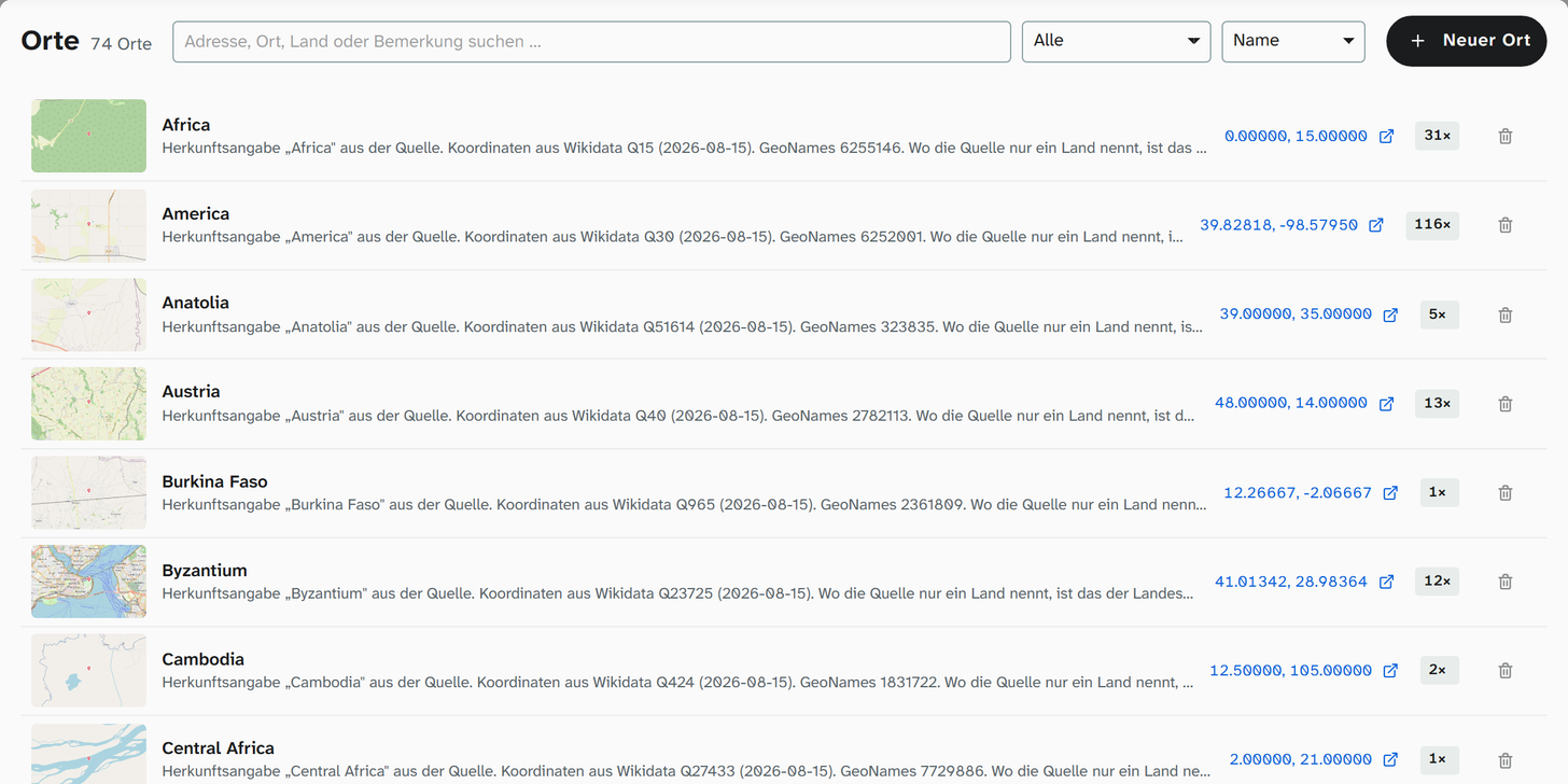
Each row shows the map preview, the name with the note, the coordinates with a link to OpenStreetMap and, on the right, how often the location is used. A click opens the location in a dialog with the tabs Search and Entry, a map with zoom and the details below it.
Both filters are work lists: Without coordinates are the locations for which no map can be produced yet; Coordinates only are those that lack a readable name.
Deleting
A location that is in use cannot be deleted. The message says Still in use and cannot be deleted. This is stricter than in the other libraries, and deliberately so: a geolocation field without a location loses not just a name but its map preview.
Map preview
A preview image based on OpenStreetMap is created from the coordinates. It appears in the library list, in the tile of the geolocation field, in the gallery, in the Excel export (column Map) and in Word reports. View on OpenStreetMap opens the location there. The image’s zoom level is set in the field configuration , not on the location.
Further reading
- Geolocation : the field type including its configuration
- Maintain locations : the procedure